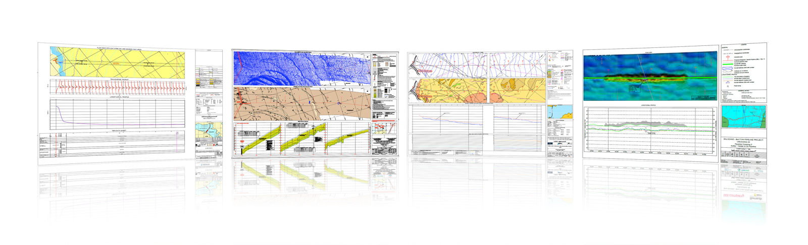
Automatic Chart Generation
HydroChart was developed as an AutoCAD extension to add value, cost and time savings in support of MariSoft “Data Processing, Charting, and Reporting Services” by automating the production of North-Up alignment sheets to comply with Client specifications presentation of Hydrographic and Geophysical Survey Data.
Benefits
- Ensure consistent chart standard.
- Simplifies the task of complex chart creation.
- Automated Chart creation / data addition.
- Route/Area based panel creation.
- Grid / Geographical lattice creation.
- KP (Kilometre Post) calculations.
- Creation of Longitudinal Profiles, Cross-Profiles and Pipeline events.
- Ability to add digitally interpret Sub-Bottom Profile data.
Chart Types
- Site Surveys
- Cable Route Surveys
- Pipeline Route Surveys
- Pipeline Route Engineering
- OOS Survey
- Strip Charts